other mapping tools new york city council districts new york city police precints school districts new york city community districts new york city zip codes new york city census tracts new york state assembly districts new york state senate districts congressional districts nyc fire companies

District Maps of the Five Boroughs

Census Tracts

There are four main ways to get census tract maps on line:

UNHP's CRG census tract maps are available as jpeg images or zoomable .pdf files

American FactFinder The American FactFinder provides access to data and maps from Census 2000 and Census 1990.

Map Viewing Guide: These instructions will guide you through using the American Fact Finder's map viewing tool to see census tract boundaries

Census Query Guide: These instructions will guide you through the process of querying community specific data from the census.

NYC Oasis Mapping Tool Created by a partnership of private and government organizations and offices, the NYC Oasis website generate street maps, aerial photos of neighborhoods, political boundaries, and census tracts showing population and median income.

NYS Social Indicator Project Mapping Tool The New York State Social Indicator Project is a mapping and database tool displaying 2000 census data at the tract level. Click on the Map Application link at the top of page and go to your region to get started. Click on the print button at the top of your map if you want to save it as an image.

^ top

Zip Codes

UNHP's CRG zip code maps are available as jpeg images or zoomable .pdfs

The Bronx
Brooklyn
Manhattan
Queens
Staten Island

NYC Oasis Mapping Tool Created by a partnership of private and government organizations and offices, the NYC Oasis website is a great alternative to generate free street maps, aerial photos of neighborhoods, political boundaries, and census tracts showing population and median income.

^ top

Community Districts

UNHP's 
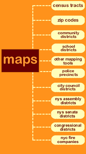
CRG community district maps are available as jpeg images or .pdf files

The Bronx
Brooklyn
Manhattan
Queens
Staten Island

Community district maps The Department of City Planning provides a detailed map of the city's 59 community districts. These maps include land use and a demographic summary of the district.

NYCHANIS The New York City Housing and Neighborhood Information System (NYCHANIS) created by the NYU Law School Furman Center for Real Estate and Urban Policy allows users to access housing and demographic data from the Housing and Vacancy Survey, Census and a number of other sources, by census tract, community district, sub-borough area, zip code and political districts, and even has mapping capabilities.

NYC Oasis Mapping Tool Created by a partnership of private and government organizations and offices, the NYC Oasis website is a great alternative to generate free street maps, aerial photos of neighborhoods, political boundaries, and census tracts showing population and median income.

NYCity Map The NYCity Map is a great resource for mapping the nearby locations of NYC services for a given address, as well as building and property information, and neighborhood information.

"State of New York City's Housing and Neighborhoods" The NYU Law School Furman Center for Real Estate and Urban Policy publishes a report entitled "State of New York City's Housing and Neighborhoods". The report contains excellent housing and demographic data and maps of NYC arranged by Community District and Sub-borough Area.

^ top

School Districts

UNHP's CRG school district maps are available as jpeg images or zoomable .pdf files

The Bronx
Brooklyn
Manhattan
Queens
Staten Island

Find a NYC school click here to continue The NYC Department of Education provides a search engine showing all elementary, intermediate and high schools in all five boroughs. Search by a given address to see all schools in an area and the progress report of each school. View the map by borough and school district.

^ top

Police Precincts

UNHP's CRG police precinct maps are available as jpeg images or zoomable .pdf files

The Bronx
Brooklyn
Manhattan
Queens
Staten Island

The NYPD precinct index click here to continue This map searches for the precinct number of an area with a given borough and address. The search will result in a map displaying the nearest precincts and links to the webpage and crime statistics of each precinct.
 

^ top

City Council Districts

UNHP's crg maps of city council districts are available as jpeg images or .pdf files

The Bronx
Brooklyn
Manhattan
Queens
Staten Island

Find your city council district click here to continue The New York City Council website allows users to search for their district representative and current district issues.

NYCity Map The NYCity Map is a great resource for finding the elected officials at the local, state, and federal level of a given address, as well as mapping the nearby locations of NYC services, building and property information, and neighborhood information.

NYC Oasis Mapping Tool Created by a partnership of private and government organizations and offices, the NYC Oasis website is a great alternative to generate free street maps, aerial photos of neighborhoods, political boundaries, and census tracts showing population and median income.

^ top

New York State Assembly Districts

UNHP's CRG maps of New York State Assembly districts are available as jpeg images or .pdf files

The Bronx
Brooklyn
Manhattan
Queens
Staten Island

Find your State Assembly representative The New York State Board of Elections provides a list of elected officials (including State Assembly representatives) for a given address.

Maps and information about Assembly Districts The Gotham Gazette's provides useful maps and information about Assembly Districts.

^ top

New York State Senate Districts

UNHP's CRG maps of New York State Senate districts are available as jpeg images or .pdf files

The Bronx
Brooklyn
Manhattan
Queens
Staten Island

Maps and information about Assembly Districts The Gotham Gazette's provides useful maps and information about New York State Senate and Assembly Districts.

^ top

U.S. Congressional Districts

UNHP's CRG maps of 108th United States Congressional districts are available as .jpeg images or .pdf files

The Bronx
Brooklyn
Manhattan
Queens
Staten Island

Find your congressional district If you do not know your congressional district, the NYCity Map will pinpoint your district and district representative from a given address. Look under the Federal tab of Elected Officials of Additional Information.

View maps of the 110th Congress If you already know your congressional district number, nationalatlas.gov allows the user to view a printable map of their district.

^ top

NYC Fire Companies

UNHP's CRG maps of NYC Fire companies are available as .jpeg images or .pdf files with street names

The Bronx
Brooklyn
Manhattan
Queens
Staten Island

View citywide and borough-wide fire statistics The FDNY site allows users to search for these statistics by monthly or annual reports.

^ top

Other Mapping Tools

Enviromapper The Enviromapper allows users to view an interactive map of their area with listings and specifics on toxic release sites and hazardous waste sites as well as other features.

NYS Social Indicator Project Mapping Tool The New York State Social Indicator Project is a mapping and database tool displaying 2000 census data at the tract level. Click on the Map Application link at the top of page and go to your region to get started. Click on the print button at the top of your map if you want to save it as an image.

NYC Oasis Mapping Tool Created by a partnership of private and government organizations and offices, the NYC Oasis website generate street maps, aerial photos of neighborhoods, political boundaries, and census tracts showing population and median income.

^ top

If you've found a useful map that isn't included in the crg, let us know and we'll post it.

all maps on crg are created by UNHP using ESRI's ArcView software and data from ESRI, NYC Department of City Planning, and LotInfo, LLC. ©2000-2008 by UNHP.

community resource guide
copyright 2000 by UNHP
comments | questions | suggestions

click here to return to UNHP's homepage

click to return to the crg homepage

community data

maps

community geography
community resources